AI-Enhanced Earth Observation: Revolutionizing Environmental Conservation with Remote Sensing and GIS
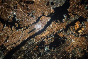
The rapid pace of global change places our environment at the forefront of these shifts. Human activities, notably climate change and deforestation, are having increasingly visible impacts, necessitating immediate action. The crucial role of remote sensing and Geographic Information Systems (GIS) in our efforts to comprehend and preserve our environment cannot be overstated. Traditionally, remote sensing involved observing Earth from afar. The advent of satellites and sophisticated imaging technologies has exponentially increased its effectiveness, revolutionizing our capacity to track environmental transformations. Presently, remote sensing is instrumental in monitoring land use changes, forest health, and other vital environmental metrics, especially on a vast scale.
The fusion of Artificial Intelligence (AI) and machine learning with remote sensing is a game-changer in the field. These innovations enable swift and precise handling of vast datasets. AI excels at discerning patterns in satellite imagery and diverse data types, allowing for more accurate interpretations of environmental shifts. This blend of AI, machine learning, and remote sensing is a significant stride forward, enhancing our efficiency and effectiveness in monitoring the Earth’s surface.
GIS's role is equally vital, particularly in analyzing spatial data. It provides an intricate understanding of the Earth’s surface and its changes over time. The emergence of web-based GIS platforms has been a key development. These platforms offer widespread access to spatial data analysis tools, fostering collaboration and data sharing among researchers, policymakers, and the public. The rise of web-based GIS platforms democratizes data access, thus bolstering our ability to monitor and interpret planetary changes.
Real-time monitoring in environmental observation marks a revolutionary step. This technology allows for instantaneous tracking of environmental changes, offering immediate feedback on the effects of both human activities and natural phenomena. As a novel component of GIS, real-time monitoring substantially improves our responsiveness to environmental shifts.
Moreover, integrating GIS with social media and crowdsourcing platforms has opened new pathways for environmental monitoring. This integration enables public participation in data collection and insight sharing, particularly valuable for local-scale changes like water quality variations or invasive species spread. The synergy of social media, crowdsourcing, and citizen science enriches our collective understanding of environmental impacts and drives joint conservation efforts.
As we face a dynamically changing world, the significance of remote sensing and GIS in environmental monitoring and protection is ever more apparent. From its inception to the dawn of web-based GIS and beyond, these technologies are reshaping our approach to environmental stewardship.
Looking ahead, the potential of remote sensing and GIS is bound to expand further. Progress in AI, machine learning, and real-time monitoring is poised to elevate our environmental monitoring capabilities. The continued integration of these technologies with social media and crowdsourcing will keep empowering citizen scientists, significantly contributing to our united environmental conservation endeavors.
These advancements not only deepen our comprehension of the Earth but also equip us with essential tools for its preservation. The capabilities of real-time, global-scale monitoring and analysis provided by remote sensing and GIS are revolutionizing our response to environmental challenges. Utilizing these technologies enables a more thorough understanding of climate change, deforestation, and other critical environmental issues, which is key to devising effective mitigation and protection strategies.
Moreover, the synergy of remote sensing and GIS with AI and machine learning is unlocking new predictive modeling and decision-making possibilities. Analyzing environmental data trends and patterns allows us to foresee future changes and proactively address emerging issues. This predictive power is vital for natural resource management, sustainable development planning, and natural disaster preparedness.
In summary, as our world continues to evolve rapidly, the importance of remote sensing and GIS in understanding and safeguarding our environment is more crucial than ever. These technologies are not mere observation tools but catalysts for action and innovation. By fully leveraging remote sensing and GIS, along with AI and machine learning advancements, we are better positioned to tackle contemporary environmental challenges and preserve our planet for the generations to come.